GISFirePRO
The satellite detects.
You get alerted.
GISFire Pro watches your zones day and night with satellite detections, and warns you from the very next pass, by email and SMS: without waiting for the press, social media, or the next morning.
14-day trial · no commitment · cancel in one click · the public map stays free · already subscribed?
New detection in “Massif Est”
- Position
- 43,282 N · 6,413 E
- Measured intensity
- 42 MW (FRP)
- Satellite
- VIIRS · NOAA-20
- Distance to the campsite
- 1.8 km
Satellites
polar (VIIRS, MODIS) and geostationary Meteosat
Press and OSINT
corroborated news, aerial firefighting assets tracked
France and Europe
the public map's full coverage
France and Europe, around the clock
From Gironde to Greece,
every fire under the satellite's eye
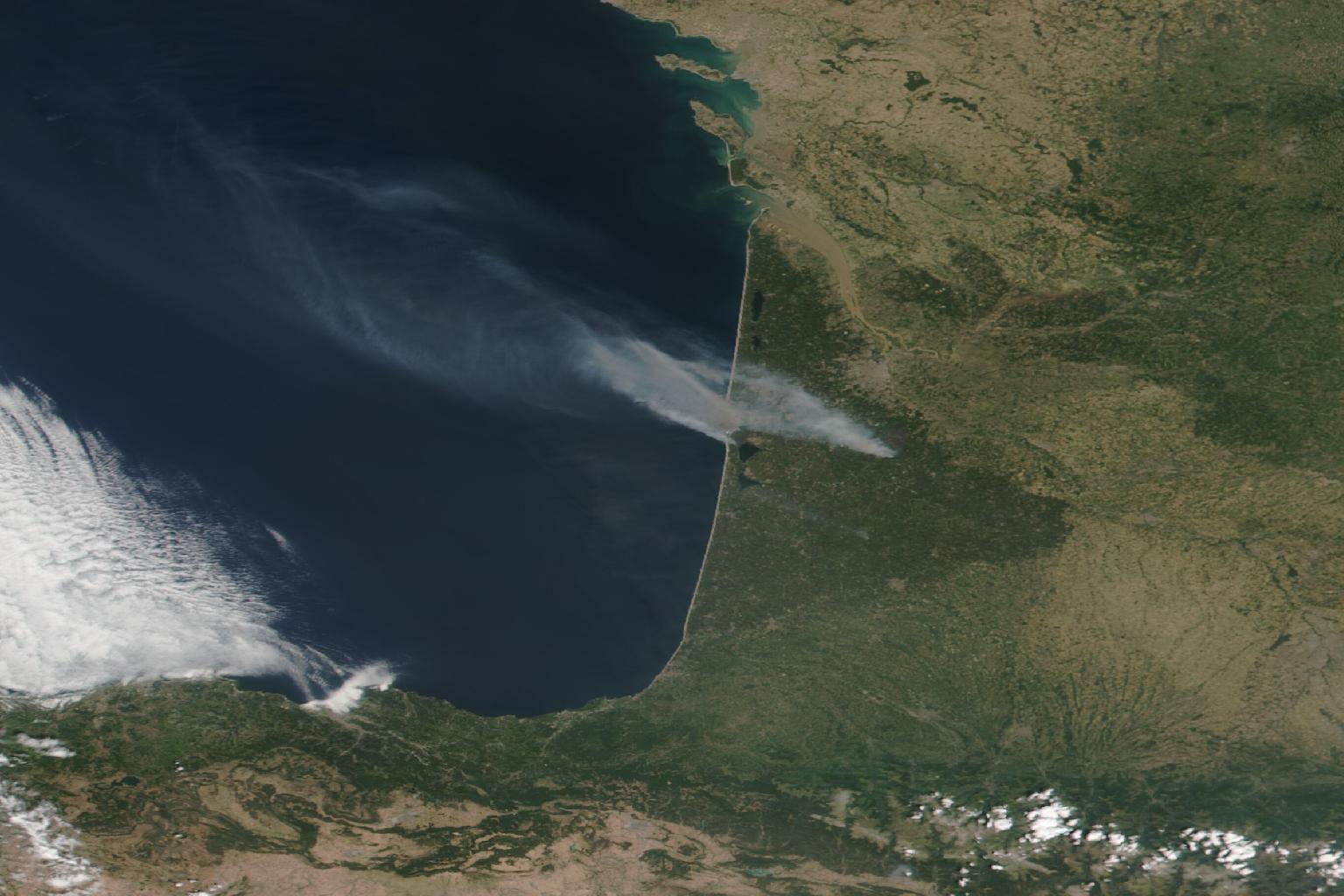
The same satellites that cover the whole Mediterranean arc watch over your zones, day and night. You no longer watch the map: it calls you.
Monitor my zonesHow it works
Three steps, then nothing left to do
Draw your zones
One free-form polygon per site to protect, in two minutes.
The systems keep watch
Polar and geostationary satellites, press and OSINT: GISFire cross-checks its sources continuously, day and night.
You get alerted
Email, urgent SMS and webhook from the first detection. With the Pro plan, also for an approaching fire, incoming smoke or lightning striking nearby.
What the subscription covers
Alert, equip, measure
Alerts on your zones
Draw your areas. At the first satellite detection, the alert goes out by email, SMS and webhook, with position, intensity and the fire's report.
API and exports
Fires, episodes and intensities in GeoJSON and CSV, through a documented API. Your GIS tools and dashboards feed themselves.
History and exposure
Fire return frequency, each site's exposure, per-period reports and a monthly summary.
The product, not a brochure
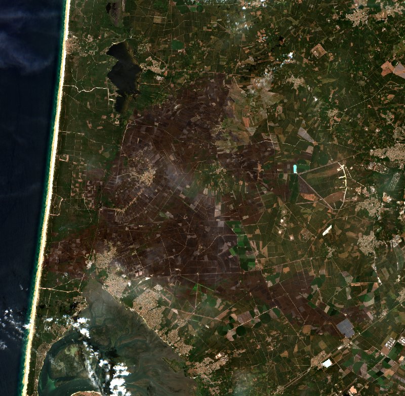
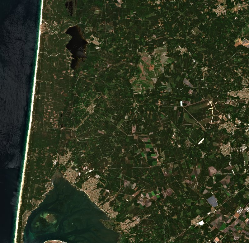
A whole fire, before and after
From intact forest to the scar on the ground. Drag the slider: these are two real ten-metre Sentinel-2 images, one taken before the outbreak, the other after extinction. The real footprint, before your eyes, not a press-release figure.
- Every fire tracked from the first pixel to the last ember
- The before is the last clear sky, the after the first one following the fire; dates are written, never guessed
- Measured footprint, cumulative power, fire return by municipality
In the press
The press cites GISFire






Press excerpts, linked to their source. GISFire solicited none of these mentions.
Pricing
The plans
14-day trial, no commitment on monthly billing; prices shown per month for yearly billing. Card payment through Stripe. See the terms of sale (in French).
Surveillance
€8.25/ month
excl. VAT, billed €99.00 / year; monthly, €12.00 / month
14-day trial, no commitment
One site to protect: campsite, estate, municipality.
- 3 zones, 25,000 ha monitored
- Email alerts
- 12-month history, reports
Pro
€82.50/ month
excl. VAT, billed €990.00 / year; monthly, €99.00 / month
14-day trial, no commitment
A data profession: GIS, insurance, forestry management.
- 25 zones, 250,000 ha monitored
- Urgent SMS on top of email
- Alert when a fire approaches, up to 50 km
- Smoke announced before it arrives
- Lightning reported around your zones
- API, exports, webhooks, 5 users
Organisation
from €200.00/ month
billed yearly, €2,400.00 / year to start
Local authorities, insurers, multi-site groups.
- Unlimited zones and users
- Everything in the Pro plan
- Negotiated area, €0.05 to €0.15 / ha / year
- GIS integration, service-level commitment
| Compare everything | Surveillance€8.25 / month | Pro€82.50 / month | Organisationfrom €200.00 / month |
|---|---|---|---|
| Monitored zones | 3 | 25 | Unlimited |
| Monitored area | 25,000 ha | 250,000 ha | Negotiated |
| Email alerts | |||
| Urgent SMS on every detection | – | ||
| Alert for an approaching fire | Inside the zone | Up to 50 km | Up to 50 km |
| Smoke announced before it arrives | – | ||
| Lightning reported around the zones | – | ||
| Webhooks to your tools | – | ||
| API, GeoJSON and CSV exports | – | ||
| Fire history and exposure | 12 months | Full | Full |
| Reports and monthly summary | |||
| Users | 1 | 5 | Unlimited |
| Guided GIS integration | – | – | |
| Priority support, service-level commitment | – | – | |
| Payment | Card | Card | Quote, bank transfer |
Before you decide
Frequently asked questions
How do I start?
You pick a plan, pay by card through Stripe, and a sign-in link lands in your inbox. In the subscriber space, you draw your zones on the map in a few clicks: they are monitored from the very next satellite pass.
How do I sign in?
No password: you enter your subscription's email address and receive a link valid for fifteen minutes. The Pro plan allows five users, each with their own address; the account holder keeps billing, the plan and the API keys.
Where does the data come from?
From several systems, the same as the public map: polar satellites (NASA FIRMS, VIIRS and MODIS) and geostationary (Meteosat, up to every ten minutes), completed by corroborated news and OSINT (water bomber trajectories). The subscription does not sell the raw data, which stays public, but the monitoring, analysis and tooling built on top of it.
How do I cancel?
Monthly plans have no time commitment: cancellation takes effect at the end of the current month, from the subscriber space or by email. Quoted plans follow their contract.
And the public map?
It stays free, whole and account-less. GISFire Pro funds its operation, it does not replace it.
Build it with us
The tool is shaped with its first users, and their needs come before our lists. Describe your activity and what you would like to monitor; we answer every message personally.
Write to contact@saro.app© 2026 SARO · Gistin. All rights reserved. The interface, its presentation and the contents of GISFire are protected; reproducing or imitating them requires written permission. The source data remain the property of their respective producers, see the credits.