Fire near Salah ad-Din (IQ)
34.90°N, 43.81°E · first detected on 8 August at 00:31
What the satellites measured
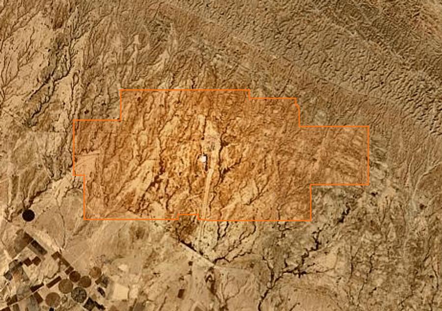
This fire was tracked from 8 August at 00:31 to 13 August at 12:53, that is 6 days, through 182 satellite detections. The detected extent reaches 883 ha.
- Detected extent
- 883 ha
- Cumulative power
- 5,424 MW
- Peak power, one pixel
- 131 MW
- VIIRS and MODIS detections
- 182
These four figures cover the polar orbits alone, the ones that measure an area. The pass table below also counts geostationary detections, more frequent but too coarse for geometry, and its power column sums a whole pass where the peak above is that of a single pixel.
“Detected extent” is not “burned area”: it is the union of the ground footprints of the satellite pixels, and a 375 m pixel counts in full even when only a forest edge is burning. Compared with press figures it is in practice one and a half to three times the area reported. Detections taken at the edge of the scan swath, too coarse to measure anything at all, are excluded. These figures come from thermal detection and are not an official assessment: only the emergency services and the competent authorities are authoritative.
Replay how the fire spread
The map is framed on this fire and loads only its detections. The timeline below covers the whole known life of the fire, from the first trace, satellite or report, to the last announcement from emergency services, and the ticks on the bar mark those announcements. Detections often stop before containment: a fire stops radiating once it stops spreading, which is exactly when it is declared contained. “1 h” shows what is burning within an hour of the chosen moment : the map then follows the power curve below and empties when it falls. “12 h” stacks twelve hours , as the home map does, where stacking avoids an empty screen between two satellite passes. Both are true, but they say different things.
The detected extent
The spread, pass after pass
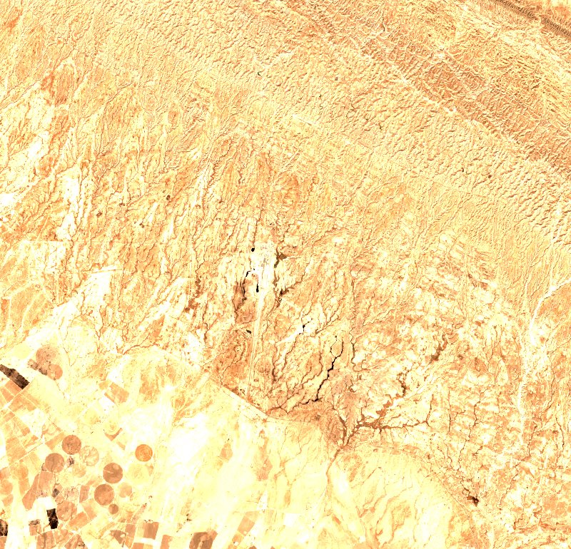
19 July
before the fire
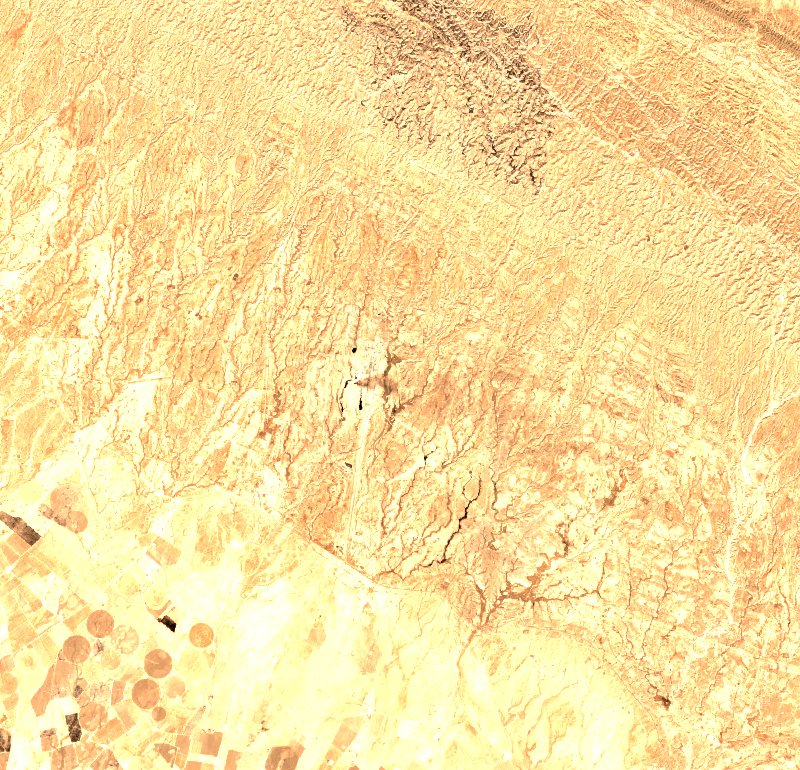
24 July
during
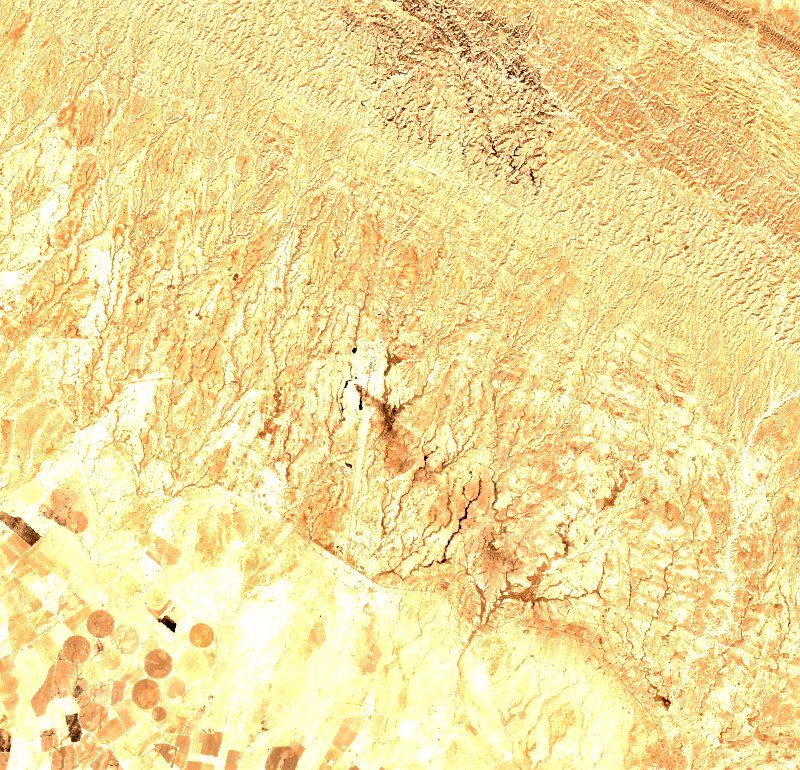
26 July
during
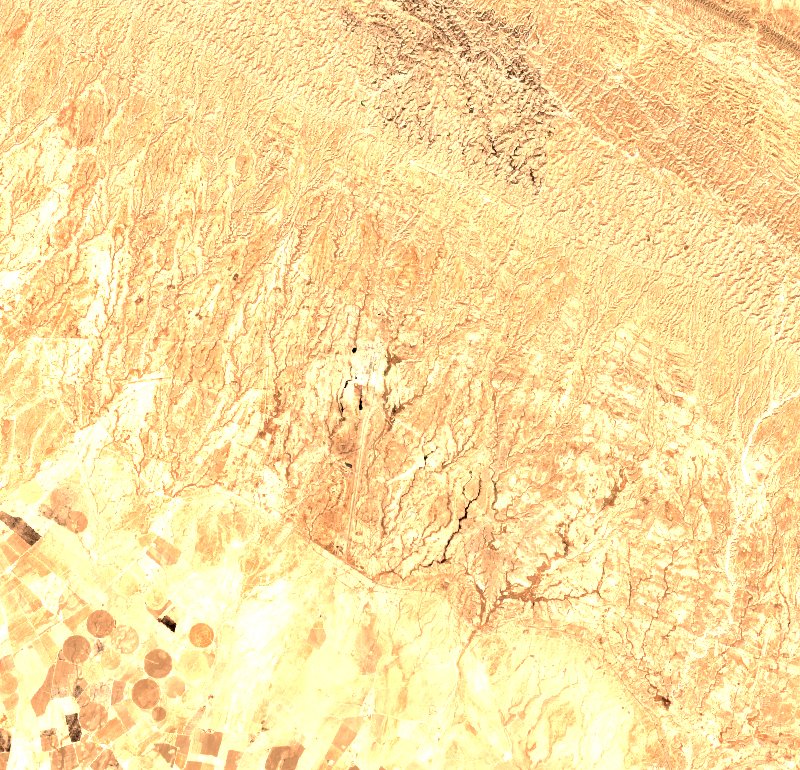
29 July
during
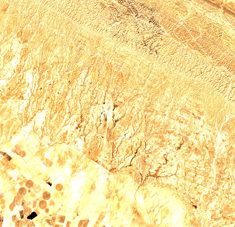
3 August
during
How the radiative power evolved
One point per satellite pass: the sum of the fire radiative power measured over the fire. This is the curve that says whether the fire eased off or picked up again, which no cumulative figure shows. The window covers 8 days; beyond that, clustering would merge two successive fires in the same place.
Fire dynamics
Loading history…
Satellite passes in detail
| Pass | Power summed over the pass | Detections | Sensor |
|---|---|---|---|
| 13 August at 12:53 | 127 MW | 4 | N20 |
| 13 August at 11:58 | 85 MW | 3 | N21 |
| 13 August at 11:13 | 74 MW | 1 | N20 |
| 13 August at 08:48 | 135 MW | 2 | Terra |
| 13 August at 03:47 | 176 MW | 2 | Aqua |
| 13 August at 01:33 | 73 MW | 2 | N20 |
| 13 August at 01:14 | 86 MW | 3 | N |
| 12 August at 23:55 | 85 MW | 4 | N20 |
| 12 August at 19:09 | 117 MW | 2 | Terra |
| 12 August at 14:08 | 62 MW | 3 | Aqua |
| 12 August at 11:13 | 162 MW | 5 | N |
| 12 August at 03:09 | 77 MW | 2 | Aqua |
| 12 August at 01:52 | 129 MW | 7 | N20 |
| 12 August at 01:33 | 36 MW | 3 | N |
| 12 August at 00:59 | 79 MW | 3 | N21 |
| 11 August at 20:09 | 114 MW | 2 | Terra |
| 11 August at 13:13 | 123 MW | 3 | N |
| 11 August at 11:32 | 207 MW | 5 | N |
| 11 August at 02:30 | 71 MW | 1 | Aqua |
| 11 August at 01:52 | 148 MW | 12 | N |
| 11 August at 01:16 | 60 MW | 3 | N21 |
| 11 August at 00:31 | 163 MW | 7 | N20 |
| 11 August at 00:12 | 175 MW | 8 | N |
| 10 August at 19:30 | 79 MW | 4 | Terra |
| 10 August at 12:56 | 135 MW | 2 | N21 |
| 10 August at 11:49 | 81 MW | 2 | N |
| 10 August at 11:13 | 98 MW | 4 | N21 |
| 10 August at 03:30 | 188 MW | 3 | Aqua |
| 10 August at 02:09 | 96 MW | 3 | N |
| 10 August at 01:35 | 110 MW | 5 | N21 |
| 10 August at 00:50 | 88 MW | 4 | N20 |
| 10 August at 00:31 | 97 MW | 4 | N |
| 9 August at 23:53 | 146 MW | 3 | N21 |
| 9 August at 18:52 | 79 MW | 2 | Terra |
| 9 August at 12:11 | 53 MW | 6 | N |
| 9 August at 11:34 | 154 MW | 4 | N21 |
| 9 August at 02:52 | 91 MW | 2 | Aqua |
| 9 August at 01:54 | 147 MW | 2 | N21 |
| 9 August at 01:07 | 75 MW | 4 | N20 |
| 9 August at 00:50 | 80 MW | 4 | N |
| 9 August at 00:14 | 105 MW | 3 | N21 |
| 8 August at 19:49 | 78 MW | 1 | Terra |
| 8 August at 12:28 | 83 MW | 6 | N |
| 8 August at 11:52 | 67 MW | 9 | N21 |
| 8 August at 11:07 | 77 MW | 3 | N20 |
| 8 August at 08:48 | 87 MW | 1 | Terra |
| 8 August at 03:52 | 67 MW | 1 | Aqua |
| 8 August at 02:13 | 260 MW | 2 | Aqua |
| 8 August at 01:29 | 96 MW | 4 | N20 |
| 8 August at 01:07 | 60 MW | 4 | N |
| 8 August at 00:31 | 86 MW | 3 | N21 |
| 7 August at 19:11 | 60 MW | 2 | Terra |
| 7 August at 14:14 | 81 MW | 2 | Aqua |
| 7 August at 13:06 | 176 MW | 3 | N20 |
| 7 August at 12:11 | 99 MW | 9 | N21 |
| 7 August at 11:26 | 81 MW | 6 | N20 |
| 7 August at 11:07 | 76 MW | 3 | N |
| 7 August at 08:10 | 109 MW | 2 | Terra |
| 7 August at 03:13 | 85 MW | 1 | Aqua |
| 7 August at 01:46 | 112 MW | 6 | N20 |
| 7 August at 01:29 | 91 MW | 5 | N |
| 7 August at 00:52 | 89 MW | 4 | N21 |
| 7 August at 00:05 | 177 MW | 12 | N20 |
| 6 August at 20:09 | 258 MW | 3 | Terra |
| 6 August at 13:36 | 187 MW | 3 | Aqua |
| 6 August at 13:06 | 129 MW | 3 | N |
One other fire near Salah ad-Din (IQ)
Separate fires, apart in time or in space, not pieces of this one. A single municipality can have several over one summer, and a forest massif often covers more than a hundred square kilometres.
Follow live
The map shows active fires in 3D, with smoke plumes, forecast wind, drop zones and the live position of water bombers tracked by ADS-B, anywhere in the world.
Open the fire mapGet the alert instead of looking for it
GISFire Pro watches the zones you draw, anywhere in the world, and warns you by email, SMS or webhook from the first satellite detection: fire in the zone, fire closing in, smoke announced before it arrives, lightning nearby. A GeoJSON and CSV API, exports and history come with it.
From €8.25 a month, 14-day trial, no commitment. The public map stays free.
Discover GISFire Pro© 2026 SARO · Gistin. All rights reserved. The interface, its presentation and the contents of GISFire are protected; reproducing or imitating them requires written permission. The source data remain the property of their respective producers, see the credits.